Santa Barbara County Motorcycle Rides
Southern California
Tepusquet Rd
17 miles - LENGTH
Narrow paved ranch road- PAVEMENT
Creek bed road, hairpins, steep - CURVES
Hwy 166 to Foxen Canyon Rd - CONNECTS
Santa Maria, Solvang, Buellton - GAS

Quick Ride: Fun ranch road connecting Highway 166 with Foxen Canyon Rd

"...like a ribbon of chocolate."
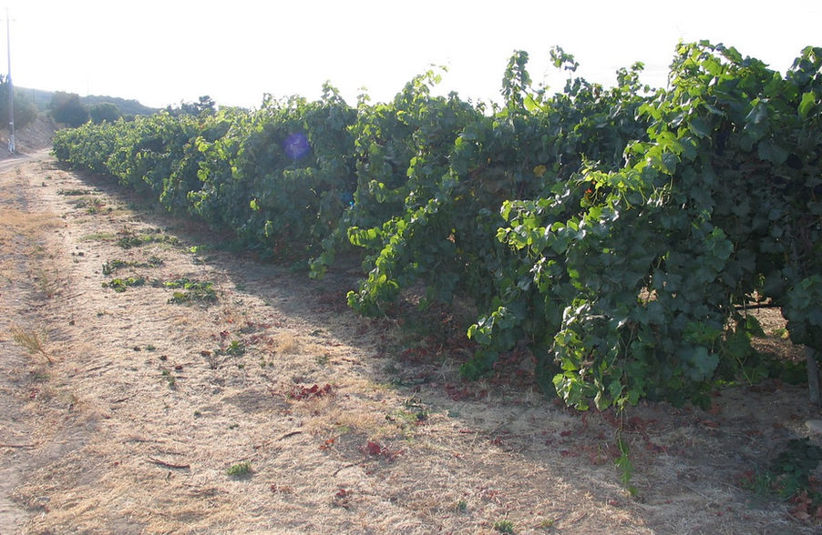
It starts out quite inconsequential. You'd never expect it. Rows of wine grapes stretch off from the road edge across the Santa Maria Valley at the south end of Tepusquet Road. Grape growing in this region dates back to the Mexican Colonial period of the 1830s. You'll find the south end of Tepusquet Rd as you're riding Foxen Canyon Road through the Santa Maria Valley, a natural funnel shaped valley that opens to the ocean while blazing over newer pavement.
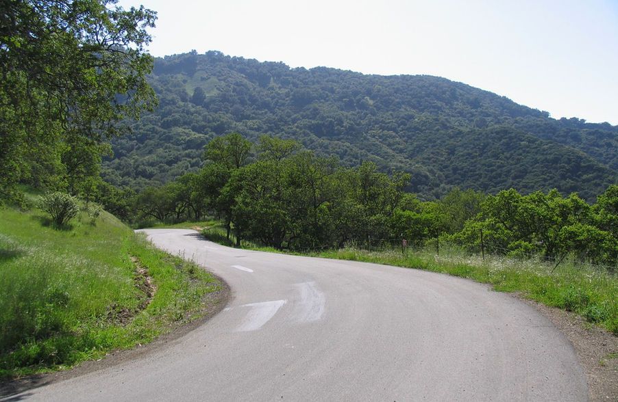
Make the turn north onto Tepusquet Road, pause for a moment - and we're off. Couple years ago, there was a short section of gravel to contend with where the bridge was washed out. But the bridge has been rebuilt and it's smooth sailing across the La Brea Creek which is a dry wash most of the year. A mile later, there is an intersection with Santa Maria Mesa Rd headed northwesterly on the north side of the wash back to Foxen Canyon Road. Make the quick stop and the best 17 miles of road for miles lies before you along the edge of Tepusquet Creek. A creek bed road is one that follows the general curves of the nearby creek usually headed up a canyon. California is full of these types of creek bed roads and they are great fun!

Tepusquet is a crescendo-building ride steadily increasing in tempo through Tepusquet Canyon, first offering up some short straights, a small hill here and there to pop over, some curves following the gentle contours of Tepusquet Creek. And it only gets better. Tepusquet Road flows up through this break in the ridgeline and proceeds to steadily gain in elevation.
Oh, but wait. The very best part? The pavement you see was paved a few years back. And this spells out a glorious ride that'll have you singing praises, or possibly laughing in glee! But that could just be me.
There are several wineries, horse farms, and driveways to contend with on this rather remote ranch road, so be mindful of any inattentive drivers pulling out onto the road. Note the sand kicked up onto the road from these driveways onto Tepusquet Rd. No center line to speak of, or any painted lines for that matter- who needs 'em! Let's ride.

And the ride- thrilling! At some point, I had to pull the motorcycle to the side of the road and laugh. Riding is like that sometimes. My riding partner caught up to me and said over the burble of engines idling happy song, "It's like a ribbon of chocolate!" Indeed.
The canyon begins to close in as you reach Suey Canyon and elevation begins to climb. Fewer homes, fewer driveways to contend with offer a welcome evolution. Note this ride is also popular with bicyclists for the same reason you're here.

We continued the ride for a few more miles with my partner leading and I following. The bike leaning to and fro, a game of Catch Me if You Can. If you thought this is too good to be true- it gets better. Ride over the 2000 ft crest, and the fresh pavement continues! Few years back this was a bumpy goat trail. The steep ride down the north side of the ridgeline was repaved in 2005.
Several hairpins are tossed out added to a few steep corners, and possible loose gravel as the ride flows off the ridge with 3253 ft Tepusquet Peak nearby to the east. At times the road is barely one lane wide. During a recent Pashnit Motorcycle Tour on this road, the opposing vehicle was kind enough to pull to the side and stop allowing all the bikes to ride on by single file with a wave and a smile. Opposing traffic is rare- you'll be lucky if you see one or two vehicles on this backroad. You don't have any reason to be here unless you're local, or a motorcyclist.

The downhill section on the north side (you can see the squiggles on the map below) is short, but does require ample concentration. Ride at a pace you're comfortable with and take it easy the first time through.
Tepusquet Road is a rare find among the plethora of California Motorcycle Roads. It's our favorite goat trail with fresh pavement- imagine that!
Nearby Motorcycle Roads - Where to next?!!
Northbound: Like dirt? Try Soda Lake Road to California City and Highway 58. Immediately north is the Los Padres National Forest and the Garcia Mountain Range, a wilderness region with zero paved roads. Fire roads? Got lots of those.
Southbound: At the south end of Tepusquet is Foxen Canyon Rd, ride Foxen Canyon southeast to Highway 154 then onto Ballard Canyon Rd and continue into Solvang to the motorcycle museum. Note Cat Canyon and Drum Canyon will circle back around to Solvang. Continue to Santa Rosa Rd.
Eastbound: Continue on Foxen Canyon, and ride a large loop from Los Olivos onto Hwy 154 and continue on Highway 192 to Highway 150 to Ojai to Highway 33 Pine Mountain. Combine Highway 33 with Lockwood Valley & Hudson Ranch Rd, FR 95 (formerly called Cerro Noroeste Rd), then back on Highway 166 back to Tepusquet Rd for a large loop. Note the option to ride up 8 miles on Cerro Noroeste Rd to 8286 ft Cerro Noroeste Peak.
Westbound: Tepusquet Rd ends (north end) at Highway 166. A turn west offers a fast but uneventful 20 miles past Twitchell Reservoir into Santa Maria. No connecting paved roads in this stretch expect Bull Canyon Rd into the heart of Santa Maria and back around to Foxen Canyon Rd for an enjoyable loop. The Pacific Ocean is a few miles to the west. Circle around south to Solvang on Santa Rosa Rd and Alisal Rd.
Tepusquet Rd - Photo Gallery
MORE INFO: Tepusquest Road
RIDE IT on a PASHNIT TOUR
17 Miles - LENGTH
Narrow ranch road, smooth, backroad - PAVEMENT
Gentle, smooth, tight, sudden, steep - CURVES
Hwy 166 to Foxen Canyon Rd - CONNECTS
Santa Maria, Solvang, Lompoc- GAS
~2500 Ft- PEAK ELEVATION
San Rafael Mountains- MOUNTAIN PASS
34°39′50″N 120°07′03″W - GPS LOCATION
None - LISTED SIDEROADS
Maps


